gvSIG bugs #3507

No puedo especificar sistema de coordenadas en las opciones de WFS
| Status: | New | % Done: | 0% | |
|---|---|---|---|---|
| Priority: | Normal | Spent time: | - | |
| Assignee: | - | |||
| Category: | WFS | |||
| Target version: | - | |||
| Severity: | Minor | Add-on version: | ||
| gvSIG version: | 2.2.0 | Add-on build: | ||
| gvSIG build: | 2310 | Add-on resolve version: | ||
| Operative System: | Linux | Add-on resolve build: | ||
| Keywords: | Proyecto: | |||
| Has patch: | Hito: | |||
| Add-on name: | Unknown |
Description
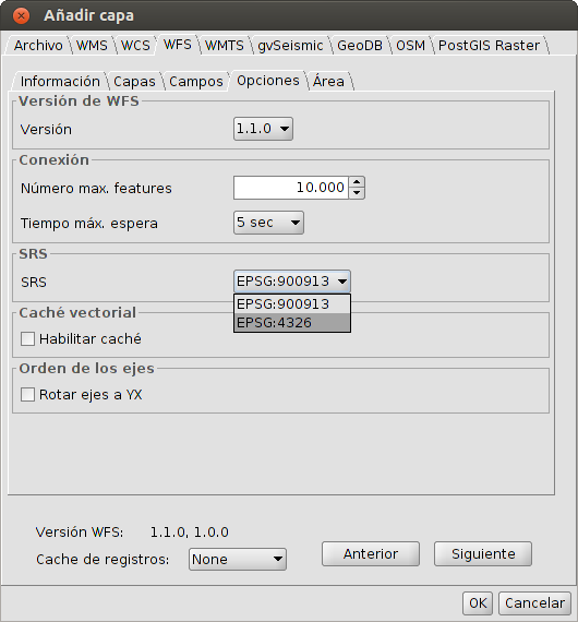
Al tratar de cargar una capa WFS 1.1.0, aunque selecciones el sistema de coordenadas del combo, gvSIG siempre realiza la misma petición. Por ejemplo:
<?xml version="1.0" ?><wfs:GetFeature version="1.1.0" service="WFS" maxFeatures="10000" xmlns:ogc="http://www.opengis.net/ogc" xmlns:wfs="http://www.opengis.net/wfs" xmlns:xsi="http://www.w3.org/2001/XMLSchema-instance" xmlns:gml="http://www.opengis.net/gml" xmlns:null="null" xsi:schemaLocation="http://www.opengis.net/wfs ../wfs/1.1.0/WFS-basic.xsd"><wfs:Query typeName="hotspots_2011_lines"></wfs:Query></wfs:GetFeature>
La consecuencia es que el servidor te responde con un GML en el sistema de coordenadas que tiene por defecto.
wfs_srs_problem.png (38 KB)
